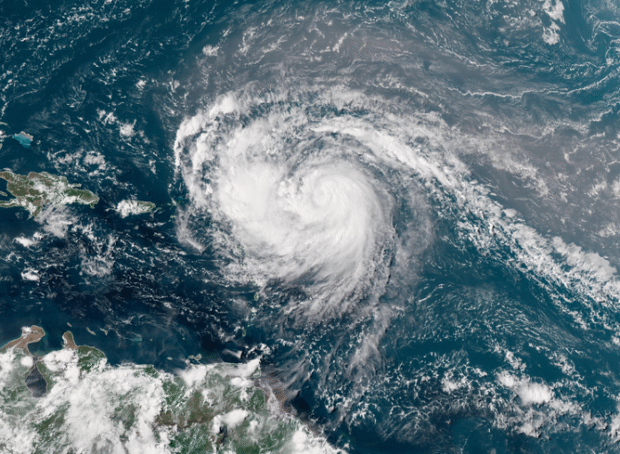
BRIDGETOWN, Barbados, CMC – Hurricane Erin is rapidly intensifying as it tracks above the northeastern Caribbean on Saturday, sending rain and gusty winds to islands south of its path.
On Saturday, Erin was a Category 4 hurricane with sustained winds of 145 mph.
The Miami-based National Hurricane Center says the storm’s winds have more than doubled in speed in the past 24 hours, increasing from a 70 mph tropical storm at 8 a.m. (local time) Friday to a 145 mph Category 4 at 8 a.m. Saturday.
Erin is located about 150 miles northeast of Anguilla,passing just north of the Leeward Islands, the Virgin Islands, and Puerto Rico this weekend while making a gradual turn toward the north.
The NHC says it 9s unlikely it will make a direct landfall on any of the northeastern Caribbean islands. However, tropical alerts are in place for some of these areas, cautioning potential threats.
A Tropical Storm Watch is in effect. – St. Martin, St. Barthelemy, and Sint Maarten. Interests elsewhere in the northern Leeward Islands, Virgin Islands, and Puerto Rico, as well as in the Turks and Caicos and the
The southeastern Bahamas are being urged to monitor the progress of Erin.


 and then